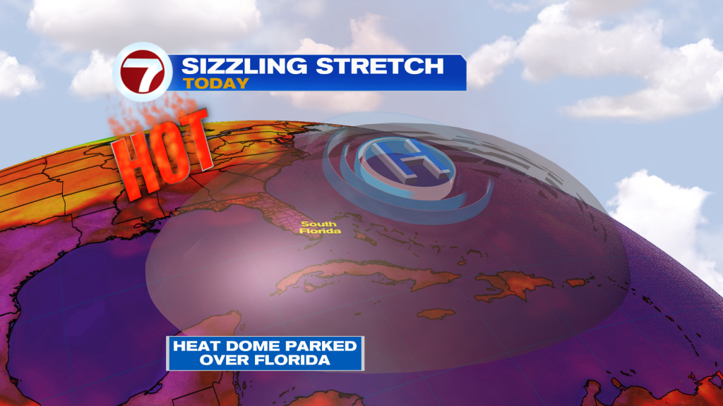
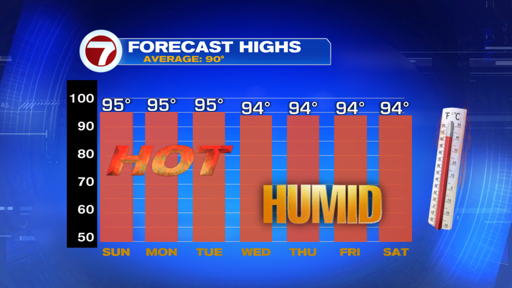
Following another day of record heat in both Miami and Marathon on Saturday, there is no sign of the heat letting up any time soon. While only Marathon is forecast to break its record for the date this Sunday, it will be another very hot day across South Florida.
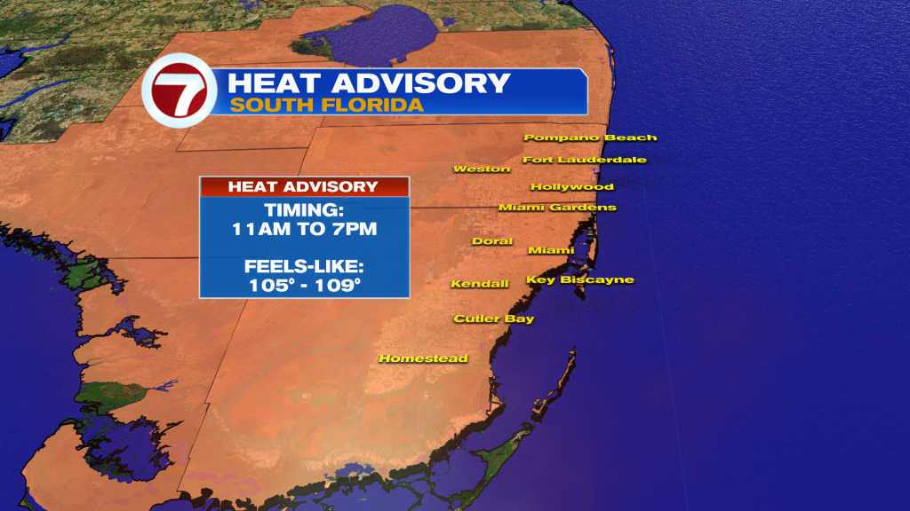
A Heat Advisory is in effect for Miami-Dade and Broward Counties this Sunday from 11AM through 7PM for peak feels-like temps of up to 105-109F.
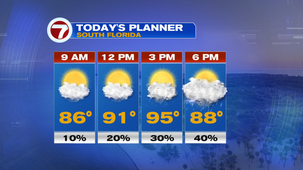
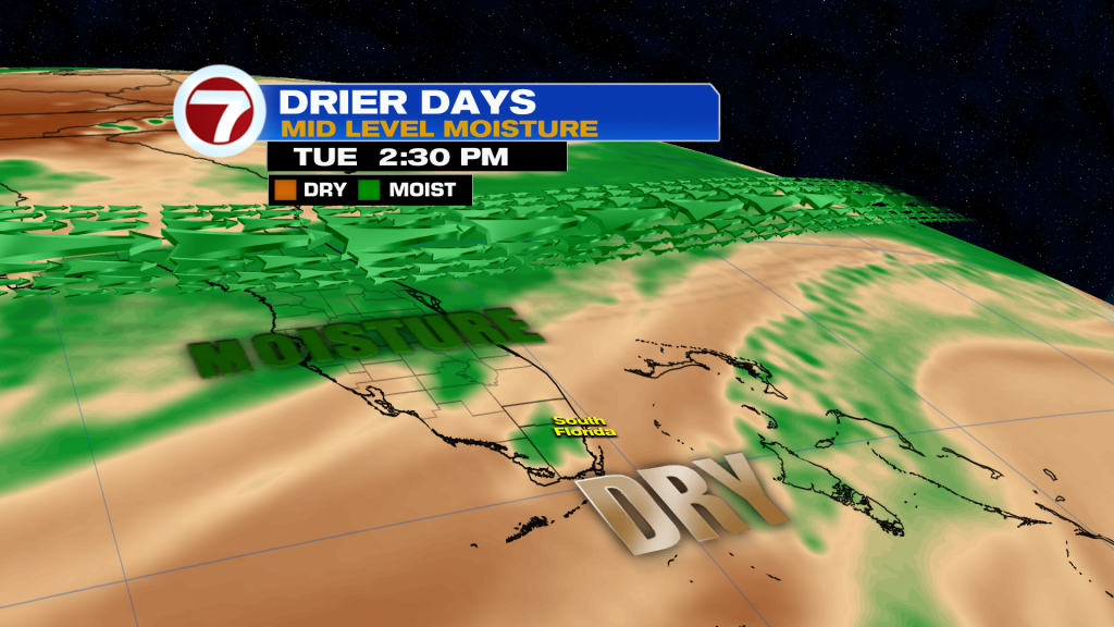
The day will begin with a mix of sun and clouds with warming temperatures, reaching the low to mid 90s by the early afternoon. Then during the mid to late afternoon hours is when we’ll have our best chance for seeing scattered showers and thunderstorms across the area. Rain chances will be lower at a 40% chance as some Saharan dust continues to move in from the south, which helps to prevent rain and storm development.
This dust will be most in place on Monday with some drier air lingering into Tuesday, meaning rain chances will be down to a 20-30% chance. This dust will help keep temperatures very hot and above average and will also create hazy skies.
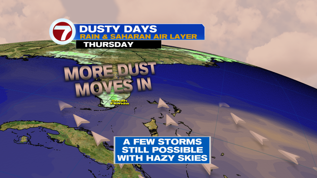
By midweek, we’ll be between dust plumes given that another batch of dust is forecast to move over South Florida by Friday. In between bataches, we could see a few additional showers and storms break out but overall rain chances will be lower than normal with more sunshine in place along with a continuation of the heat wave.
Highs will remain in the 90s over the next 7 days with feels-like temperatures in the triple digits.
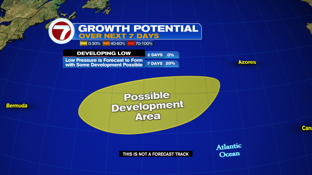
In the tropics, the National Hurricane Center is watching an area of potential formation over the North Atlantic Ocean with a 20% chance a developing low becomes a tropical system.